Satellite Image Classification with Machine Learning & Python — Part 1: Creating Model and Classifying
Last Updated on June 11, 2024 by Editorial Team
Author(s): KokaTic
Originally published on Towards AI.

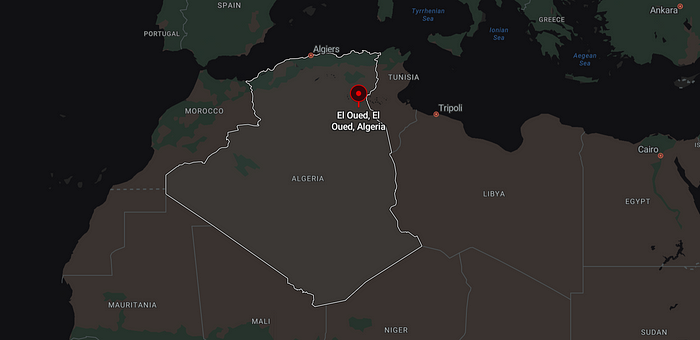
Study region of our tutorial — El Oued, Algeria (source: Bing maps)
Image classification is a pivotal task in the realm of machine learning, particularly within the domain of remote sensing. In this series, we embark on a journey to delve into the intricacies of image classification using Python.
Our focus will be on leveraging the Random Forest algorithm to classify Sentinel 2 data over the astonishing landscape of El Oued, nestled in the heart of the Algerian desert. Renowned for its vast agricultural expanse, El Oued stands as one of the foremost agricultural producers in the country, making it an ideal canvas for our exploration.
Note: Do not confuse image-based classification with pixel-based classification. In this context, we’re focusing on pixel-based classification, where we assign a label to each individual pixel.
Extraction from our imge: El Oued, Algerie – Sentinel 2 image in Avril 2024
In this journey, we will need to install:
Python 3.10+QGIS 3.X.X + for visualisation
We will need also to :
Datasets to download from Copernicus site, we will work on a Sentinel 2 2A image of 30 Avril 2024 (image ref: T32SKC_20240430T102021).You can download it from the Copernicus Platform; you can check their documentation to download data.
During this beginner’s tutorial, we will… Read the full blog for free on Medium.
Join thousands of data leaders on the AI newsletter. Join over 80,000 subscribers and keep up to date with the latest developments in AI. From research to projects and ideas. If you are building an AI startup, an AI-related product, or a service, we invite you to consider becoming a sponsor.
Published via Towards AI
Take our 90+ lesson From Beginner to Advanced LLM Developer Certification: From choosing a project to deploying a working product this is the most comprehensive and practical LLM course out there!
Towards AI has published Building LLMs for Production—our 470+ page guide to mastering LLMs with practical projects and expert insights!

Discover Your Dream AI Career at Towards AI Jobs
Towards AI has built a jobs board tailored specifically to Machine Learning and Data Science Jobs and Skills. Our software searches for live AI jobs each hour, labels and categorises them and makes them easily searchable. Explore over 40,000 live jobs today with Towards AI Jobs!
Note: Content contains the views of the contributing authors and not Towards AI.


